Kladovo (Opština Kladovo)
 |
In Serbian, the town is known as Kladovo (Кладово), in Romanian Cladova, in German as Kladowo or Kladovo and in Latin and Romanised Greek as Zanes. In the time of the Roman Empire, the name of the town was Zanes while the fortifications was known as Diana and Pontes (from Greek "sea" -pontos, or Roman "bridge" - pontem). Emperor Trajan had a number of fortications constructed in the area during the Roman times, such as the well-known Trajan's Bridge (Pontes was built on the Serbian side, Theodora was built on the Romanian side). Later, Slavs founded a settlement that was named Novi Grad (Нови Град), while Ottomans built a fortress here and called it Fethülislam. The present-day name of Kladovo is first recorded in 1596 in an Austrian military document.
There are several theories about the origin of the current name of the town:
* According to one theory (Ranka Kuic), name of the town derived from Celtic word "kladiff" meaning "cemetery" in English.
* According to another theory (Ranko Jakovljevic), the name derived from the word "klad" (a device used to hold a person shackled).
* A third theory has it that the name derives from the Slavic word "kladenac" meaning "a well" in English or from the Slavic word "klada" meaning "(tree) stump".
* There is also a theory that the name goes back to the Bulgarian duke Glad, who ruled over this region in the 9th century.
There is a settlement with the same name in Russia near Moscow and it is believed that this settlement was founded by Serbs who moved there from Serbian Kladovo in the 18th century. One of the suburbs of Berlin also has this name, which originates from the Slavic Lusatian Serbs (Sorbs) who live in eastern Germany.
The name is also found in the Arad and Timiș counties of Romania, Cladova, in Arad county Cladova, Arad, Cladova in Timiș county Cladova, Timiș
Map - Kladovo (Opština Kladovo)
Map


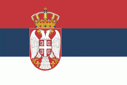
Country - Serbia
 |
 |
| Flag of Serbia | |
Continuously inhabited since the Paleolithic Age, the territory of modern-day Serbia faced Slavic migrations in the 6th century, establishing several regional states in the early Middle Ages at times recognised as tributaries to the Byzantine, Frankish and Hungarian kingdoms. The Serbian Kingdom obtained recognition by the Holy See and Constantinople in 1217, reaching its territorial apex in 1346 as the Serbian Empire. By the mid-16th century, the Ottomans annexed the entirety of modern-day Serbia; their rule was at times interrupted by the Habsburg Empire, which began expanding towards Central Serbia from the end of the 17th century while maintaining a foothold in Vojvodina. In the early 19th century, the Serbian Revolution established the nation-state as the region's first constitutional monarchy, which subsequently expanded its territory. Following casualties in World War I, and the subsequent unification of the former Habsburg crownland of Vojvodina with Serbia, the country co-founded Yugoslavia with other South Slavic nations, which would exist in various political formations until the Yugoslav Wars of the 1990s. During the breakup of Yugoslavia, Serbia formed a union with Montenegro, which was peacefully dissolved in 2006, restoring Serbia's independence as a sovereign state for the first time since 1918. In 2008, representatives of the Assembly of Kosovo unilaterally declared independence, with mixed responses from the international community while Serbia continues to claim it as part of its own sovereign territory.
Currency / Language
| ISO | Currency | Symbol | Significant figures |
|---|---|---|---|
| RSD | Serbian dinar | дин or din. | 2 |
| ISO | Language |
|---|---|
| BS | Bosnian language |
| HU | Hungarian language |
| SR | Serbian language |
